Diesel Station Near Me: Find Best Prices, Parking, and Fuel Fast
How Do Drivers Find a Diesel Station Near Me Without Wasting Miles?
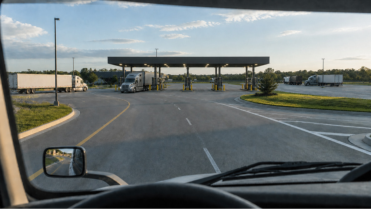
When the fuel gauge drops and the day is getting long, the nearest diesel pump is not always the right move. A lot of bad fuel stops look fine on a phone map until the truck gets closer and the road narrows, the curb lane disappears, or the station sits just far enough off route to turn a quick fuel break into a long detour. Most drivers check more than distance. They want diesel fuel near me that sits along the route, not several turns off it, and they want to compare a few truck stop options before committing. Trucker Path helps there by showing fuel prices along the route and pairing that with commercial routing that avoids low bridges, weight-restricted roads, and roads that were never built for a tractor-trailer. The practical move is simple: pick the stop that costs less overall, not just less at the sign. If one station is a little farther ahead but has a straight in-and-out from the interstate, room for a sleeper cab and trailer, and a better setup for the next leg, a lot of guys take that over a closer pump that creates a second problem right after fueling.What Makes One Fuel Stop Better Than the Next Late in the Day?
Cheap fuel loses its shine fast when the lot is packed and the clock is working against the driver. By late afternoon, the decision changes from “Where can I fuel?” to “Where can I fuel and still have a decent shot at parking without bouncing to two more lots?” That is the part regular maps miss. Trucker Path shows live truck parking status — open, full, or closed — based on driver reports, which gives a better read on whether the stop can actually finish the day. Instead of fueling at one place and then hunting around with minutes left, a lot of drivers look for one stop that covers both needs. The app also helps compare the full stop, not just the pump. If one diesel gas station near me has parking trending full and another farther ahead has easier truck access, more room to line up, and a better chance to shut down there, that second stop often wins. Fewer moves at the end of the day usually means less stress and less wasted time.Check Fuel and Parking Along Your Route
How Do Nearby Weigh Stations and Road Conditions Affect the Fuel Stop Decision?
Fuel stops do not happen in a vacuum. A station can look good until traffic stacks up near an interchange, road work squeezes the right lane, weather rolls in, or a nearby scale changes the flow around the exit. Drivers are not looking to dodge anything there. They are trying to avoid getting trapped in a bad approach with a full-size rig. That is where having road awareness in the same app matters. Trucker Path includes weigh station information from crowdsourced driver reports plus official data feeds, alongside traffic, weather, and live highway cameras. Used together, that gives drivers a better feel for how the area is moving before they burn the ramp and commit the truck. A lot of guys also check the stop in context with the next few hours. If weather is building ahead, or traffic around the intended fuel stop already looks ugly, it can make more sense to fuel earlier while access is still simple. If road conditions look clean and parking farther ahead has a better shot, drivers can keep rolling without making a rushed last-minute call.When Fuel Is Tight, What Is the Fastest Way to Make the Call?
Late-day fuel decisions get worse when the information is split across three or four apps. One shows prices, one shows traffic, one has parking, and none of them route like a truck. That is how drivers lose ten minutes checking screens, miss a clean fuel stop, and wind up committing to the next exit with less information than they had twenty miles back. The faster move is one screen that answers the whole problem. Trucker Path combines commercial-safe GPS, along-route fuel price comparison, live parking reports, weigh station information, traffic, weather, and highway cameras in one view. Apple CarPlay support and detailed junction view also help when the day is winding down and nobody wants a last-minute lane mistake in a busy interchange. That matters because the last hour of the day is usually not when anyone wants to experiment. Most drivers want one answer fast: where to stop for diesel, get in without a mess, and have a decent shot at ending the day without another loop around town.Frequently Asked Questions
How do I find diesel near me that is actually truck accessible?
Look beyond straight-line distance. Most drivers check whether the station sits on a truck-safe route, has room for big rigs, and will not force a tight entrance, low-clearance approach, or awkward turnaround. An app with commercial routing helps narrow that down fast — “near me” should mean near the truck’s route, not just near the phone’s location.What is the difference between diesel near me and diesel fuel near me in search?
Usually not much. Drivers use both phrases when they want nearby diesel pumps, but the real need is usually broader than fuel alone. They are also looking for access, parking, and a stop that fits the truck — which is why route-based fuel search tends to be more useful than a general local search.How do I find a diesel gas station near me with parking?
Most drivers search for fuel first, then realize parking is the harder part late in the day. Checking live parking status before exiting helps avoid fueling at a stop that cannot finish the night. A lot of guys compare two or three fuel stops ahead and take the one that gives them both diesel and a realistic parking option.Can I check a weigh station near me while planning a fuel stop?
Yes, and the useful part is trip awareness, not routing around enforcement. Drivers want to know what is happening near the area so they can plan the stop with a better read on timing and traffic flow. That works best when weigh station information sits beside traffic, weather, and route planning in the same view.Is the closest diesel station always the cheapest stop for a truck?
Not always. A nearby stop can cost more overall if it takes the truck off route, adds slow city traffic, or leaves no parking after fueling. Most experienced drivers compare the full stop cost in time and miles, not just the pump price. With regional diesel spreads running over a dollar per gallon in 2026, a little comparison before the exit can add up across the week.Summary
- Diesel station near me is a routing question, a parking question, and a timing question all at once — the nearest pump is not always the right stop
- With regional diesel spreads over $1.50 per gallon between the Gulf Coast and California, comparing a few along-route options before the exit pays off
- Late in the day, most drivers look for one stop that covers fuel and parking together rather than solving each problem separately
- Traffic, weather, highway cameras, and weigh station information help drivers pick a cleaner stop with fewer surprises on the approach
- One app that handles GPS, fuel, parking, and road awareness cuts down on bad guesses when time is tight